
Trace a Shaler Township Street Directory
The address-to-record trail in Shaler Township begins with the free Allegheny County property form, not with a name search. It can return address candidates and parcel context for a street, but it is an assessment and property source. It does not establish every person connected with an address. Keep the physical location, parcel identifier, municipality, date searched, and any separate mailing fields in distinct notes. That makes later document and map checks easier to compare.
The useful order is address, parcel, owner role, recorded document, authorized civic-list procedure, then historical clue. A county result can identify the parcel used by the assessment system. A recorder result can tie a party to a dated instrument. A voter list, where law allows and the request is approved, has its own rules and cannot be republished online. A yearbook or regional directory may supply an older association, but neither proves a present connection to the address.
- Open the Allegheny County Real Estate Portal, choose Address, and enter the house number when it is known.
- Enter the bare street name without a suffix, then select Shaler in the Municipality control when that is known.
- Save the parcel or map-block-lot clue and compare the physical location with owner and tax mailing fields.
- Use Official Record Search for party, document, subdivision, or date research after checking the legal-description clues.
- Use the Pennsylvania Street List or Walking List procedure only for a permitted purpose, then test older leads against dated local sources.
Note: A street-name result is a parcel starting list, not a public roster of every household on that street.
Shaler Township Address Search Fields
The county’s address route has a small, specific set of controls. Street-only searching is supported, and the county directs users to omit suffixes such as “St.” or “Dr.” from Street Name. The Municipality selector is especially important around Shaler Township because postal place names and municipal boundaries do not always agree. The free form provides Address and Parcel Number paths. Free owner-name entry is not part of this public interface.
The Real Estate Portal entry screen shows the address and parcel search paths used for a Shaler Township address search.
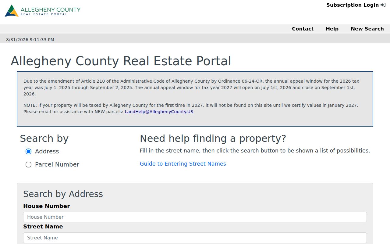
Use the result as a starting point for the selected property record, then preserve its source date before moving to another record system.
| Portal control | Form type | Needed? | Use for a Shaler street |
|---|---|---|---|
| Address | Search path | Select one path | Opens the street and number route. |
| Parcel Number | Search path | Select one path | Use after a PIN or parcel is known. |
| House Number | Text | Optional | Narrows a particular address. |
| Street Name | Text | Effectively needed | Use the bare name, without a suffix. |
| Municipality | Dropdown | Optional | Select Shaler to reduce similar-name results. |
| Search | Button | Not applicable | Returns possible matches for the selected route. |
Shaler Township Parcel Addresses
One Allegheny parcel can carry three address concepts. The situs is the physical property location. Owner mailing is where assessment-change and appeal notices may go. Tax mailing can be different again when another arrangement handles tax bills. These fields are useful evidence about how county systems label a parcel, yet none alone confirms a complete household list or a current personal connection.
- Parcel
- A county property unit identified for assessment and mapping purposes.
- Situs address
- The physical property location used by the assessment record.
- Map-block-lot
- A parcel identifier used to connect mapped property context with county record research.
- Plat or plan
- A recorded map or subdivision document that can explain lots, blocks, or a changed parcel layout.
- Criss-cross directory
- A directory arranged by address rather than by name. No verified Shaler run was located.
The Property Record Card can supply more detail than the web display. Allegheny County says it may be requested free by email at LandHelp@AlleghenyCounty.us, or obtained as a paper copy at the County Office Building copy desk for $0.25 per page. Request the specific parcel rather than assuming a street name alone identifies the correct property.
Map Shaler Township Street Parcels
The county GIS Viewer supplies the spatial part of a Shaler Township address search. Search the address, center the map, and click parcel polygons along the street segment. The county identifies address search, parcel information, layers, measurement, printing, sharing, pan and zoom, and basemap changes as viewer capabilities. It does not publish a promise that the map popup supplies a named owner field, so use the map for location and parcel context, then return to the property portal for the record side.
Allegheny County GIS identifies the viewer tools available for an address and parcel check.
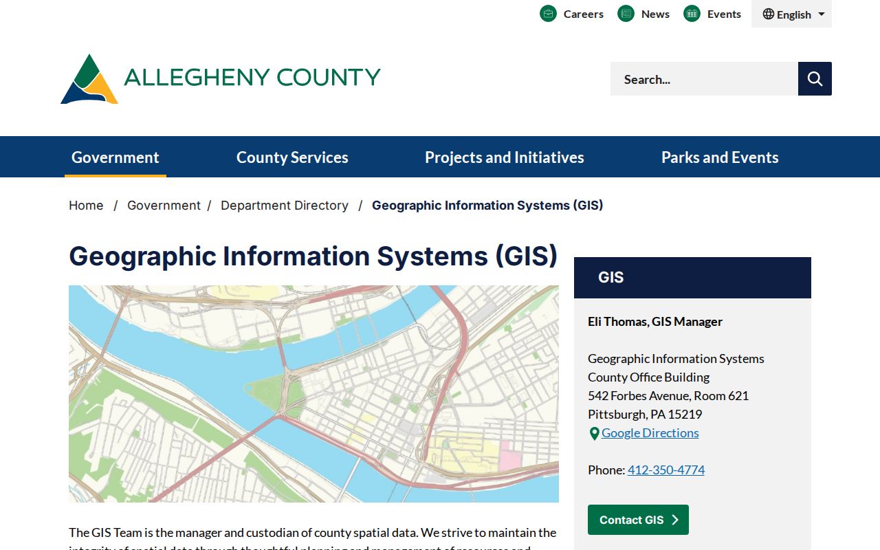
Clicking nearby polygons is more reliable than guessing from a street-number sequence, particularly where a plan or irregular lot interrupts the pattern.
Record the displayed PIN or MAPBLOCKLOT when available. The viewer’s parcel layer exposes those identifiers and county geometry. Measurement provides spatial context only. It is not a legal boundary decision or evidence about who is present at an address.
Follow Shaler Township Deed Records
The recorder’s public system is not an address finder. After the property route supplies a parcel clue, use the legal description, map-block-lot, a party name, document number, subdivision, or recorded date to investigate the recorded trail. The Official Record Search offers a term field for grantor/grantee, subdivision, document type, or document number. It also offers a recorded-date range and separate index-only and index-plus-full-text OCR scopes.
Allegheny Official Record Search is the county’s public entry for the land-record index and its two search scopes.
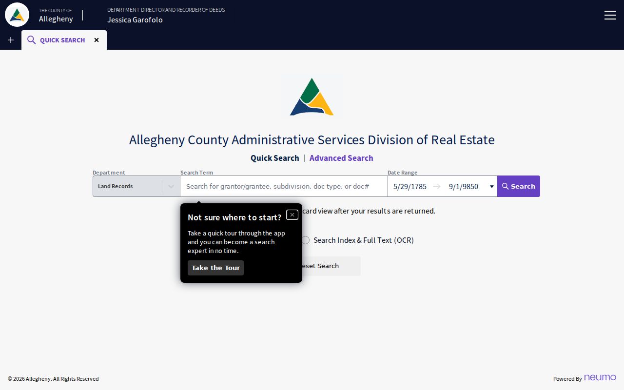
A result must be checked against the document date and legal description before it is treated as part of the same parcel trail.
Grantor means the party transferring an interest, and grantee means the party receiving it. Those roles describe one instrument, not a permanent resident status. If a document points to a subdivision, a plan, or a changed lot description, pause and inspect that record before joining it to an earlier transaction. County land-record information also identifies deeds, mortgages, subdivision plans, block and lot maps, historic plats, and property history cards as record categories.
Shaler Township Address Geography
Address corrections have two custodians. Shaler Township has authority to assign or correct a local address. Allegheny Address Management consolidates countywide address data, maintains the 911-response address file, and routes county updates through its process. That division matters when an assessment page, parcel map, or postal label appears inconsistent. A USPS label does not settle municipal jurisdiction, and changing it does not by itself correct a county property record.
Allegheny Address Management explains the county and municipal roles in an address update.
For an actual new or corrected local address, contact Shaler first, then use the county process for synchronization with county systems.
This local geography is also historical. Shaler formed in 1847 from territory that included what later became Etna and Millvale, along with parts of Ross. Etna and Millvale incorporated in 1868. Older material can therefore use Millvale, Etna, Ross, Glenshaw, Pittsburgh, or Allegheny County wording instead of the modern township name.
Note: Preserve the municipality and parcel identifier when comparing records that use different postal names for the same area.
Shaler Township Permit History
Township Building & Zoning records can date a change at an address. The public permit page lists building, accessory zoning, street-opening, sanitary-sewer tap, subdivision, zoning, fence, right-of-way, and related application categories. Cloudpermit is an account-based route for an applicant’s own application, status, inspection scheduling, revisions, and time-stamped messages. No broad public historic address index was located.
Shaler’s Building Permit and Cloudpermit page describes the applicant workflow and permit categories.
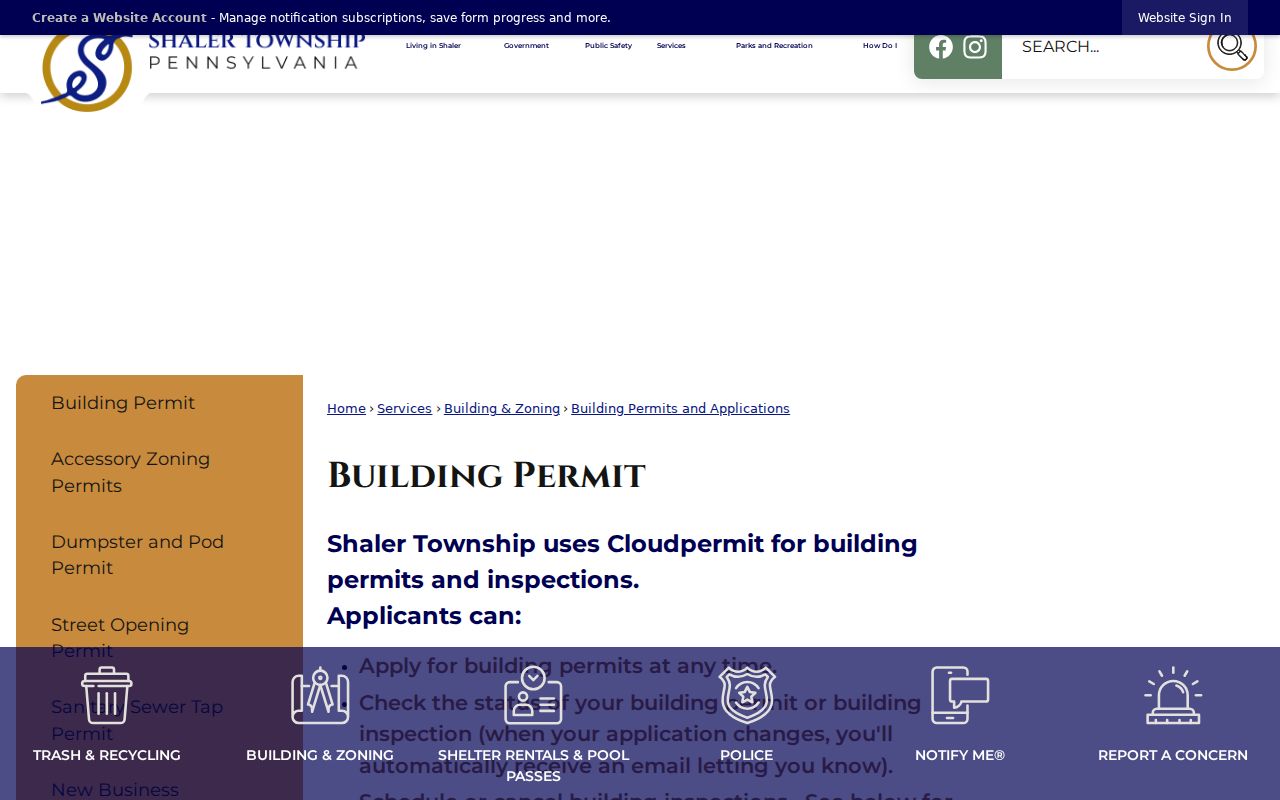
For a historic address record, call Building & Zoning at 412-486-9700, extensions 234 or 216, or submit a focused township request.
Shaler’s Right-to-Know request route accepts a specific request by mail, email, fax, or hand delivery. The township says it does not accept anonymous requests. Its normal initial response is five business days, with a possible extension of up to 30 calendar days. State the address, date range, and record type. A permit can date an alteration or project, but it does not create a complete list of people linked to that address.
Shaler Township Voter Procedures
Pennsylvania’s public registration-status route is for an individual to verify their own status. It is not a browseable street tool. The state also identifies a county office and 1-877-VOTESPA as alternatives for status questions. For Allegheny County procedures, the Elections Division is at 542 Forbes Avenue, Room 312, Pittsburgh, with published phone number 412-350-4500.
The Pennsylvania voter-list form is the documented route for an authorized street-oriented list. A Street List includes name, residential and mailing addresses, party, and active or inactive status. A Walking List omits mailing address. Each electronic list costs $20, requires identification and an affirmation of permitted use, and may not be published on the internet. The request is countywide or statewide in scope, so it does not turn the live status lookup into public street browsing.
Address Confidentiality Program participants can use a substitute address in covered voter and government records. Do not attempt to reconstruct a protected location. An absent result can reflect an access limit or protected status rather than a conclusion about a person.
Shaler Township Street Directory Records
Address-keyed sources can be combined when their limits are kept visible. The property portal and GIS Viewer identify a parcel from a street. The recorder identifies recorded parties and documents. Township records may hold a particular permit or requestable material. Historical sources can create leads that require geographic checking. The table separates those sources so a mailing field, document party, or map label is not mistaken for proof of a complete list of people.
| Street-chain source | Address question | Shaler route | Useful output | Limit |
|---|---|---|---|---|
| County property search | Which parcel matches the address? | Real Estate Portal | Address, parcel context, assessment and owner-history type data | No free owner-name search. |
| GIS Viewer | Which parcels continue along the block? | County GIS | Parcel geometry, PIN, MAPBLOCKLOT | Map browsing is not personal-status data. |
| Property Record Card | What additional property data is retained? | LandHelp or copy desk | Detail beyond portal display | Request a specific parcel; paper copy is $0.25 per page. |
| Recorded documents | Which instruments involve the parcel? | Official Record Search | Party, document, date, subdivision relation | Verify legal description. |
| Township permits | What project record may exist? | Building & Zoning, Cloudpermit, RTKL | Project or inspection timing | No public historic street index located. |
| Authorized voter list | Is a civic street list available? | State request form | Street or Walking List where permitted | Restricted use and no internet publication. |
The county recorder offers copies in person, by mail, or online through its land-record options. Assessment-copy assistance also runs by phone, email, fax, or mail. When a portal fails, the documented counter, request, and copy paths are better alternatives than inferring a missing record from a search result.
Shaler Township Historical Addresses
For an older address clue, Shaler North Hills Library has digitized and print Shaler Area School District yearbooks from 1934 through 2018, except 1943 and 1954. A yearbook can connect a name to a school-era activity or photograph. It does not verify a street address. Historic Pittsburgh holds regional directories published by J. F. Diffenbacher and R. L. Polk between 1815 and 1945, primarily for Pittsburgh and Allegheny City with some nearby borough coverage.
Check a volume’s title and geography before treating an address entry as Shaler evidence. No verified Shaler reverse or criss-cross directory run was located. The local and regional collection details belong in the Shaler Township Directory Book; use a result from that historical shelf alongside parcel, deed, plan, or census evidence.
Shaler Township Address Limits
Property records identify a parcel and the roles appearing in county fields. Recorder results identify parties in recorded instruments. Neither is a complete personal roster. Utility account information is not a general public list, and driver information has federal privacy protection. Court categories can also be sealed, expunged, juvenile, or limited-access. The responsible conclusion is narrowly tied to the record type, date, parcel, and custodian.
Pennsylvania’s Address Confidentiality Program provides a substitute address for eligible participants in covered public-facing records. Voter-list requests also carry statutory restrictions. If a needed item is missing, ask the actual custodian about access or correction procedures rather than trying to bypass a protection. Allegheny County’s Property Fraud Alert is a safer use of the land-record system: it notifies a watcher when a document is recorded under a watched name, then the document number and legal description should be checked with the recorder.
Note: A document party, mailing destination, or parcel owner should always be described as a record role, not as a complete household finding.