
Previous Residents at a Shaler Address
Shaler previous residents research is best arranged by era. Start with the current physical address, then save the municipality, ZIP used by the record, PIN or map-block-lot, and legal-description wording. The county property system establishes the parcel doorway. Recorded documents can connect transfers through named parties and dates. Historical collections, census schedules, and township records may add the household layer, but no one source supplies a complete occupant history.
| Source | Years it covers | Where held | What it shows |
|---|---|---|---|
| County Real Estate Portal | Current or modern portal; no universal historical cutoff published | Allegheny County web portal | Address or parcel doorway and county-described owner history |
| Official Record Search | Current portal; online start year not stated by county | Division of Real Estate index | Grantor, grantee, document, and recorded-date trail; no address search |
| County historical land records | 1792-1857 materials identified by county | Division of Real Estate historical records | Early grants, patents, record books, and special series; availability varies |
| Historic Pittsburgh directories | 1815-1945 core corpus | Historic Pittsburgh | Name and address clues only if the volume covers the target place |
| Shaler school yearbooks | 1934-2018, except 1943 and 1954 | Shaler North Hills Library | Name, class, and community association, not a street directory |
| Federal census | Released after 72 years | National Archives and authorized access partners | Household snapshot that needs address and enumeration-district checks |
| Shaler permits | Current public page; historic online cutoff not located | Building & Zoning or RTKL route | Project or inspection timing if the record exists |
Begin with the parcel for a modern address. Move to deeds when a transfer is the question. For an older household, test a census or regional directory only after checking locality. The source sequence changes with the date, and a missing result can reflect access, indexing, an alternate place name, or a protected record.
Shaler Previous Residents by Era
The address trail becomes less direct as it moves back in time. The county names historical materials from 1792 through 1857, while the Pennsylvania State Archives provides Land Office paths for warrants, surveys, and patents. Those early land records establish tract origins, not who occupied a later building. Historic Pittsburgh can provide a regional name-and-address lead, but its published geography must reach the target. The local school collection is stronger for a school-era association than for a house history.
No official Shaler house-history guide or designated house-history service was found. The supported fallback is practical: bring the parcel and deed citations to the library, Carnegie, Pitt, or another county-recommended research institution; then test historic maps, regional directories, yearbooks, newspapers, probate material, and census evidence where the date fits. Exact Sanborn volumes or years for Shaler were not located in the official research, so do not assume a map sheet exists for a particular address.
Note: An early land reference may concern a tract rather than the later structure at the street address now in use.
Tracing Shaler Previous Residents Through Deeds
A deed trail begins with the current parcel, not a surname. The free Allegheny County Real Estate Portal searches by address or parcel number. Its address route uses house number, street name, and an optional municipality. For street-name searches, the county says to omit a suffix and choose Shaler when that helps distinguish similar names. Save the PIN or map-block-lot and the legal description where available before opening the recorder search.
The Allegheny County Real Estate Portal provides the parcel starting point shown below.
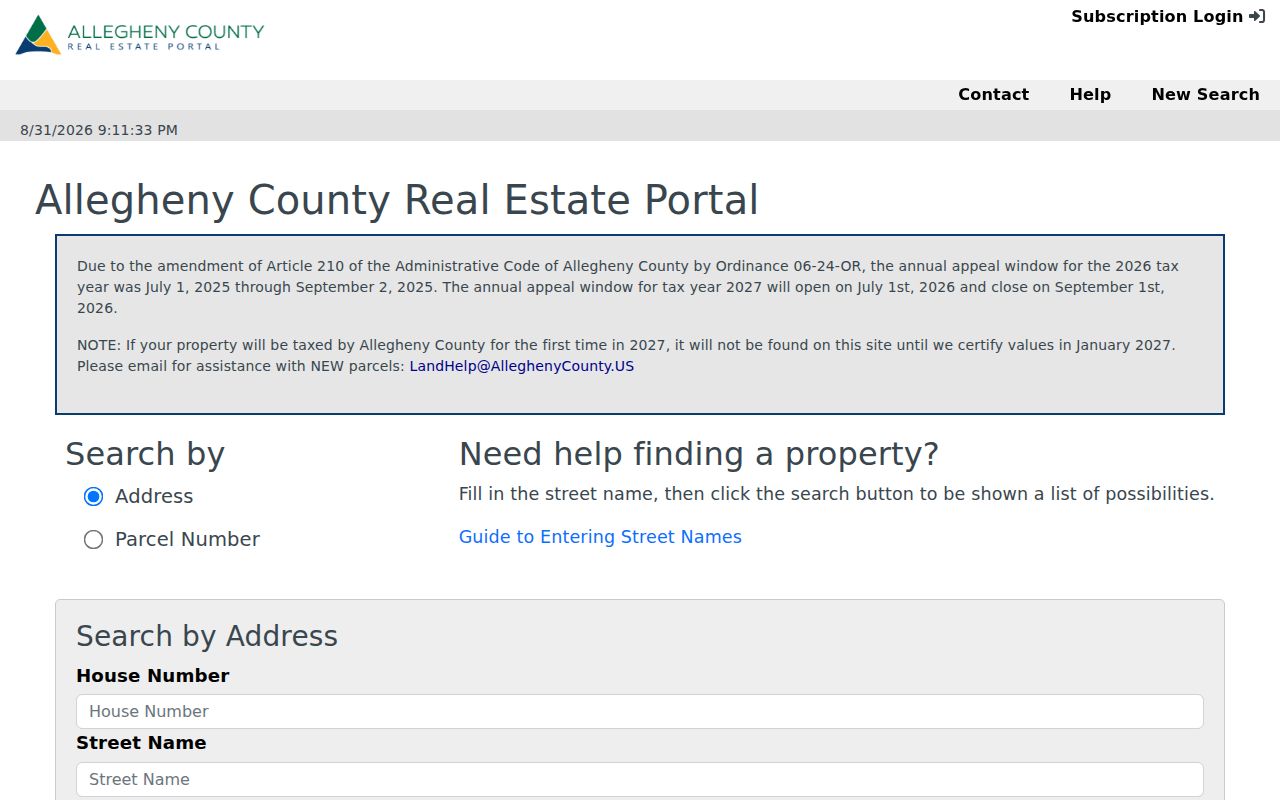
Use the parcel identifiers from this first result to keep the later deed search tied to the same property.
- Locate the physical address and preserve the municipality, PIN or map-block-lot, source date, and the separate situs, owner-mailing, and tax-mailing fields.
- Use the latest transfer or owner-history clue to find the related document or party in Official Record Search.
- Read the matching deed citation, then compare its legal description, plan, lot, acreage, and recording date with the parcel.
- Search the former party in the grantor or grantee route to locate the earlier transfer, repeating the same parcel checks at every link.
- Pause when a legal description changes without a documented lot conversion, then inspect plans, historic plats, or an official copy before continuing.
- Grantor and grantee
- The grantor transfers an interest in a recorded document; the grantee receives that interest. These are document roles, not proof of residence.
- Chain of title
- The sequence of recorded transfers tied to the same parcel or legal description. A sound chain carries the parcel identifiers and dates through each link.
- Legal description
- The lot, block, plan, acreage, or other land wording used to identify the property in a document. It is safer than a street label when old addresses change.
- Enumeration district
- The census geography assigned to a group of addresses. Record it with the census page so a household snapshot can be checked later.
Shaler Grantor-Grantee Record Checks
Allegheny’s Official Record Search is name, document, and date oriented. Its Quick Search accepts a term for grantor or grantee, subdivision, document type, or document number, plus a recorded-date range. It offers an index-only scope and an index-and-full-text OCR scope. The address itself is not a direct search field. This is why the parcel bridge comes first.
The Official Record Search shows the county’s recorded-document search route.
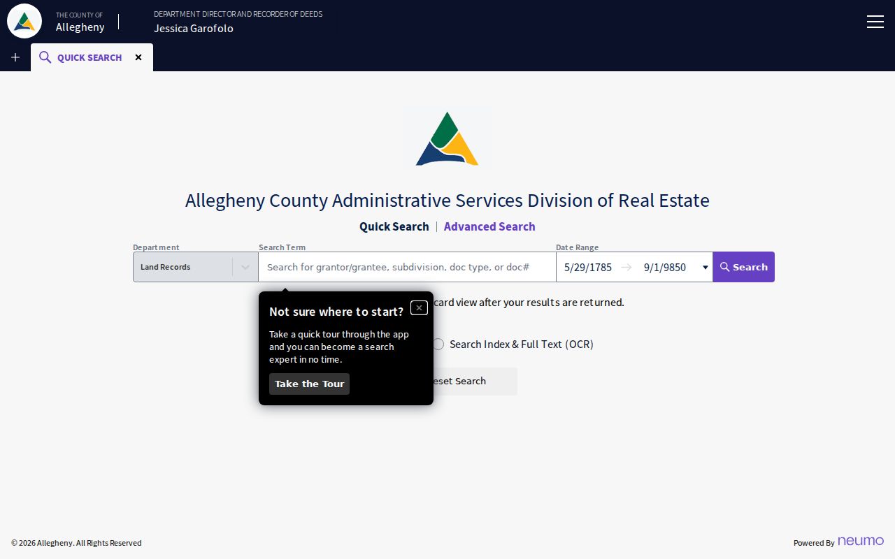
Multiple entered words in the index-only mode are searched individually; the OCR mode treats multiple words as a phrase across document content. An OCR hit is still only a lead until the document number, recording date, and legal description match the parcel. The inspected official source did not publish a complete anonymous result-field legend, so do not infer an image, a complete title chain, or a household list from an index hit alone.
Shaler Previous Residents and Old Boundaries
Shaler’s geography can break an otherwise careful search. The township was formed in March 1847 from land that included present Shaler, later Millvale and Etna, and parts of Ross. Etna and Millvale incorporated in 1868, and Shaler became a first-class township in 1900. A family or parcel may therefore appear in older material under Millvale, Etna, Ross, Glenshaw, Pittsburgh, or Allegheny County instead of the present township label.
Postal language creates a second issue. Addresses serving Shaler can use Glenshaw, Allison Park, Pittsburgh, Sharpsburg, or Etna. Match the municipality, parcel identifier, legal description, and nearby landmarks before deciding that two different place names refer to one address. The township history also names Cherry City, Bauerstown, Cabbage Hill, Sharps Hill, Undercliff, Elfinwild, and Glenshaw as useful historical search terms.
For a former household, this geographic work protects against overlooking a record filed under an older locality. It also prevents a nearby result from being treated as a Shaler address without evidence.
Shaler School-Era Residence Leads
Shaler North Hills Library’s digitized yearbooks are a valuable local association source for previous residents research. The verified 1934-2018 run, with the 1943 and 1954 gaps, can place a person in a class, activity, photograph, or school community. It cannot by itself put that person at a particular street address. Pair the volume and page with a dated parcel, census, deed, obituary, or estate source before describing a household connection.
The Shaler yearbook collection is the verified local school-era source.
For a former classmate or a family connection, capture the class year, page, caption, and access date. Those details make it possible to test the clue later without treating a photograph or name as an address record.
Past Shaler Households in Census Records
Ownership is only one part of a previous-residents trail. Federal census schedules, released after 72 years, provide a historical household snapshot. The local directory material is regional, not a verified Shaler reverse run, so first test the volume’s geography. The school collection provides a separate school-era lead. Used together, they can help establish a sequence without turning any one entry into proof of continuous residence.
- Choose the directory, yearbook, deed, or parcel clue closest to the time period under review.
- Find the nearest available census and preserve the enumeration district, page, locality wording, and address context.
- Compare names and age or family context with the dated property or recorded-document trail.
- Check a regional directory only after the title and place coverage could include the address.
- Use an obituary, estate file, will search, or historical certificate only for the question that source can answer.
Allegheny County Wills & Orphans maintains wills, estates, marriage records, and Orphans’ Court files. Its mailed will-search request is a narrow route for an heir inquiry and requires a $10 money order. A public estate file may identify an estate representative or heir context, but a deed alone is not family proof. For a lawful family or estate question, preserve the record role and filing date.
The county’s will-search request information is the official starting point for that focused route.
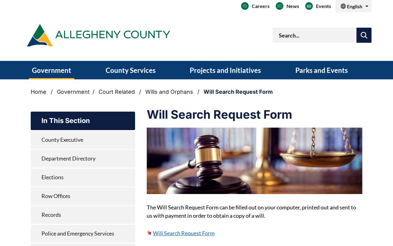
Keep the request date and any public-file citation with the other dated evidence in the trail.
Lawful use. Use previous-resident evidence for personal history, family research, estate questions, or property research. Do not use a record trail to track, threaten, harass, or harm a living person.
Shaler Previous Residents and Permit Dates
Shaler Building & Zoning records can date changes to a property, including building, accessory zoning, street-opening, sanitary-sewer tap, subdivision, fence, right-of-way, and other permit categories. Cloudpermit is an applicant account route for a specific application, inspection status, revisions, and time-stamped messages. The public page does not provide a historic all-address permit index.
The township’s Building Permits and Applications page is the source for the permit route below.
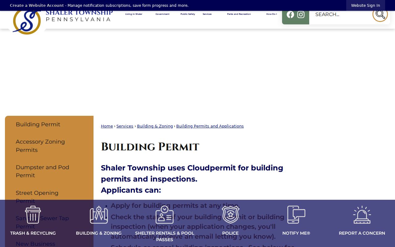
For an older property file, contact Building & Zoning or submit a specific Pennsylvania Right-to-Know Law request that identifies the address, approximate dates, and record type. A returned permit can document project timing and details held in the file. It does not prove ownership or a complete household unless the record itself supports that conclusion.
Note: The township is the fallback for its own records, while deeds and assessments remain county-held sources with different request routes.
Limits on Shaler Previous Residents Results
A no-result does not show that nobody lived at the address. The record may use a different spelling, a historic locality, a mailing place, an unindexed date range, or a protected address. The county property portal distinguishes physical property location, owner mailing, and tax mailing. Those fields have different county purposes and do not identify every person in the structure.
Record the exact search terms, source date, and unproductive range before changing tactics. Use the appropriate custodian: the Division of Real Estate for land documents, county historical records or State Archives for older land material, the library and regional rooms for historical collections, Court Records for a public estate file, and the township for its own permits or other nonexempt records.